Overview
of the Earth Observation System of Iberian America
Zhao, C. L.1,2 Zhang, Q. Q.1,2 Fan, J. L.3* Franch, B.4 Liu,
C.5 Zhao,
X. X.5
1. National Satellite Meteorological Center
(National Centre for Space Weather), Beijing 100081, China;
2. Innovation Center for FengYun Meteorological
Satellite (FYSIC), Beijing 100081, China;
3. Advanced Interdisciplinary Institute of Satellite
Applications, Faculty of Geographical Sciences, Beijing Normal University,
Beijing 100875, China;
4. University of Valencia, Valencia 46100, Spain;
5. Institute
of Geographic Sciences and Natural Resources Research, Chinese Academy of
Sciences, Beijing 100101, China
Abstract:
The Global Earth Observation System of Systems (GEOSS) is a coordinated and
independent system of Earth observation, data processing and information
retrieval that interacts and provides various Earth observations and decision
support information to a wide range of public and private sector users. The GEOSS
is built on top of Earth observation systems constructed by countries around
the world according to their own development needs. The Iberian countries are a
large group of Spanish and Portuguese speaking countries, with a population of
approximately 680 million. Their Earth observation systems have significant
characteristics, with nearly one-third of the 22 countries independently or
jointly developing their own high-resolution optical or radar satellite Earth
observation systems. The high-resolution satellite image data collected is
playing an important role and used for land resource management, disaster risk
management, deforestation and illegal logging, crop monitoring, road
monitoring, and national security. The independent development of Earth
observation systems in Iberian American countries has a reference value for the
development of Earth observation systems in developing countries.
Keywords: GEOSS; Iberian America; satellite system; Earth
observation; GEO
DOI: https://doi.org/10.3974/geodp.2024.04.05
CSTR: https://cstr.escience.org.cn/CSTR:20146.14.2024.04.05
1 Introduction
The Global Earth Observation
System of Systems (GEOSS) is a coordinated and independent system of Earth
observation, data processing and information retrieval that interacts to
provide information on the state of the Earth and decision support for public
and private sector decision-making. The goal of GEOSS is to establish a global
integrated Earth observation system framework with a holistic concept and
organizational structure that meets user needs, serving decision-making at all
levels, particularly in relation to human health and safety, protecting the
global environment, reducing natural disaster losses, and achieving sustainable
development. Through the implementation of the GEOSS Second Decade
Implementation Plan, it hopes to make outstanding progress in key areas,
conduct annual, ten-year, and longer-term comprehensive monitoring of global
and regional climate, generate information products related to biodiversity and
climate change, improve global and multi system information acquisition and
processing capabilities for disaster prevention and reduction, resource and
environmental protection, and biodiversity conservation, and provide decision
support information for key users and decision-makers[1,2].
GEOSS is a global integrated system built on top of
the Earth observation systems constructed by countries around the world
according to their own development needs. Given that the Iberian countries are
predominantly Spanish speaking and Portuguese speaking, and have distinctive
Earth observation systems, this article provides an overview of the development
trends and applications of Earth observation systems in these countries. It is
hoped that this will serve as a reference for the development of Earth observation
systems in developing countries.
The Iberian American countries[3]
include 19 Spanish and Portuguese speaking countries in Latin America, as
well as other countries in the Iberian Peninsula of Europe, including Spain,
Portugal, and Puerto Rico. These 22 countries are Argentina, Paraguay, Panama,
Brazil, Peru, Bolivia, the Dominican Republic, Ecuador, Colombia, Costa Rica,
Cuba, Honduras, Mexico, Nicaragua, El Salvador, Guatemala, Venezuela, Uruguay,
Chile, Spain, Portugal, and Puerto Rico. Figure 1 shows the distribution of
Iberian American countries.
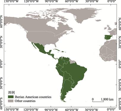
Figure 1 The geographical location of Iberian American countries
The total population of Iberian American countries is
approximately 680 million, with Brazil having over 210 million, Mexico having
125 million, Colombia having 49 million, Spain having 46 million, and Argentina
having 44 million among the more populous countries[3].
According to the United Nations Development Programme??s statistics on the
Iberian American countries in 2023, Spain, Portugal, Puerto Rico, Chile, Costa
Rica, Argentina, and Uruguay have a high Human Development Index[4]
(HDR).
2 Earth Observation Systems in
Iberian American Countries
The main countries developing Earth
observation systems in Iberia American countries include Spain, Argentina,
Portugal, Brazil, Colombia, Mexico, Uruguay, Chile, Paraguay, Peru, Ecuador,
Costa Rica, Guatemala, and Venezuela. Among them, countries such as Spain,
Argentina, and Brazil have successively launched several Earth observation
satellites, possessing strong global comprehensive Earth observation
capabilities.
2.1 Spain
Spain is an important member of the Earth
Observation Organization from Europe, and its remote sensing satellites
typically have high resolution, multispectral imaging capabilities, and a long
service life. The sensors carried on Spain??s remote sensing satellites can
provide high-resolution images, which are widely used in various fields such as
environmental monitoring, agricultural assessment, and urban planning. The main
observation areas of the Spanish Earth Observation System are Spanish
territory, Europe, Iberian America, and North Africa. These characteristics
make Spain??s remote sensing satellites competitive internationally and widely
used worldwide.
2.1.1 GEOSAT-1
GEOSAT-1[5] was launched
in July 2009 and is a high-resolution multispectral optical small satellite for
Earth observation. It is part of the Disaster Monitoring Constellation (DMC).
The GEOSAT-1 satellite has an orbit altitude of approximately 661 km and is in
a sun synchronous near circular orbit with an orbital period of 97.7 minutes.
GEOSAT-1 is equipped with a multispectral imager MS, which has green, red, and
near-infrared bands with a spatial resolution of 22 m. The global average
revisit time for ultra wide swath images is 2?C3 days, and the average revisit
time for mid latitude regions is 1?C2 days. The spectral characteristics are
shown in Table 1. GEOSAT-1 provides important vegetation index parameters such
as Normalized Difference Vegetation Index (NDVI), Green Normalized Difference
Vegetation Index (GNDVI), Red Edge Chlorophyll Index (RECI), Soil Adjusted
Vegetation Index (SAVI), and Modified Soil Adjusted Vegetation Index (MSAVI),
and also provides images for commercial applications, government use, and rapid
response after disasters occur.
Table 1 Spectral characteristics
of GEOSAT-1 Satellite Sensors[5]
|
Band
|
Name
|
Spectral range (nm)
|
Ground Sampling Distance (m)
|
Standard Ortho (m)
|
|
1
|
NIR
|
770?C900
|
22.0
|
20.0
|
|
2
|
Red
|
630?C690
|
22.0
|
20.0
|
|
3
|
Green
|
520?C600
|
22.0
|
20.0
|
2.1.2 GEOSAT-2
GEOSAT-2[6] is a
continuation of GEOSAT-1, launched on November 21, 2013. The GEOSAT-2 satellite
has a sun synchronous near circular orbit with an altitude of 630 km, an
inclination angle of 98 degrees, and a revisit period of 4 days. This is
achieved by the ability to point at the lowest point with a maximum deviation
of ?? 45 degree[7]. The satellite
carries a high-resolution camera with 5 spectral channels (1 panchromatic+4
multispectral), and the spectral characteristics are shown in Table 2.
Table 2 Spectral characteristics
of GEOSAT-2 Satellite Sensors[6]
|
Band
|
Name
|
Spectral range (nm)
|
GSD (m)
|
Standard Ortho (m)
|
Enhanced Ortho (m)
|
|
1
|
NIR
|
770?C892
|
4.0
|
3.0
|
2.0
|
|
2
|
Red
|
640?C697
|
4.0
|
3.0
|
2.0
|
|
3
|
Green
|
532?C599
|
4.0
|
3.0
|
2.0
|
|
4
|
Blue
|
466?C525
|
4.0
|
3.0
|
2.0
|
|
5
|
Panchromatic
|
560?C900
|
1.0
|
0.75
|
0.40
|
2.1.3 PAZ
PAZ[8] (Spanish means ??peace??) is a Spanish Earth
observation and reconnaissance satellite launched on February 22, 2018. PAZ
operates in the same orbit as the German TerraSAR-X and TanDEM-X dual
satellites, with the three satellites working together as a constellation. PAZ uses
high-resolution X-band synthetic aperture radar
(SAR). The sensor characteristics are detailed in Table 3. PAZ flies in a polar
dawn dusk sun synchronous orbit, covering the entire Earth with an average
revisit time of 24 hours. It uses two ground stations (Madrid and Canary
Islands) to obtain data, with an average delay of slightly over one day. PAZ is
capable of high-resolution mapping of large areas during both day and night,
for military operations, border control, intelligence, environmental
monitoring, natural resource conservation, urban and infrastructure planning,
and natural disaster monitoring.
Table 3 Statistics of characteristics
of Spanish high resolution X-band SAR Satellites[8]
|
Mode ID
|
StripMap Single (SM-S)
|
StripMap Dual (SM-D)
|
Scan SAR (SC)
|
Wide Scan SAR (WS)
|
Spotlight Single (SL-S)
|
Spotlight Dual (SL-D)
|
High-resolution Spotlight
Single (HS-S)
|
High-resolution Spotlight Dual
(HS-D)
|
Starring Spotlight (ST)
|
|
Polarizations
|
HH, VV, HV, VH
|
HH/VV, HH/HV,
VV/VH
|
HH, VV, HV, VH
|
HH, VV, HV, VH
|
HH, VV, HV, VH
|
HH/VV, HH/HV
VV/VH
|
HH, VV, HV, VH
|
HH/VV, HH/HV,
VV/VH
|
HH, VV,
HV, VH
|
|
Scene size (Range?? Azimuth) (km)
|
30??50
|
15??50
|
100??
150
|
[273?C
196]??208
|
10??10
|
10??10
|
[10?C6]??5
|
10??5
|
[9?C4.6]??
[2.7?C3.6]
|
|
Range Resolution (m)
|
MGD, GEC, EEC[SE]
|
2.99?C3.52 at
[45???C20??]
|
6
|
N/A
|
N/A
|
1.55?C3.43 at
[55???C20??]
|
3.09?C3.5 at
[55???C20??]
|
1?C1.76 at
[55???C20??]
|
2?C3.5 at
[55???C20??]
|
0.96?C1.78 at
[45???C20??]
|
|
MGD, GEC,
EEC[RE]
|
6.53?C7.65 at [45???C20??]
|
7.51?C10.43 at [45???C20??]
|
16.79?C18.19 at [45???C20??]
|
35
|
3.51?C5.43 at
[55???C20??]
|
4.98?C7.63 at
[55???C20??]
|
2.83?C3.11 at
[55???C20??]
|
4?C6.2 at
[55???C20??]
|
0.97?C1.78 at
[45???C20??]
|
|
SSC
|
1.1 [150 MHz] 1.7
(100 MHz]
|
1.18
|
1.17?C
3.4
|
1.75?C3.18
|
1.18
|
1.17
|
0.6
|
1.17
|
0.59
|
|
Azimuth
Resolution (m)
|
MGD, GEC, EEC[SE]
|
3.05
|
6.11
|
N/A
|
N/A
|
1.56?C2.9 at
[55???C20??]
|
3.53
|
1?C1.49 at
[55???C20??]
|
2.38?C2.93 at
[55???C20??]
|
0.38?C0.7 at
[45???C20??]
|
|
MGD, GEC, EEC[RE]
|
6.53?C7.60 at
[45???C20??]
|
7.52?C10.4 at
[45???C
20??]
|
17.66?C
18.18 at [45???C
20??]
|
39
|
3.51?C5.4 at
[55???C20??]
|
4.99?C7.64 at
[55???C20??]
|
2.83?C3.13 at
[55???C20??]
|
4?C6.25 at
[55???C20??]
|
0.97?C1.42 at [45???C20??]
|
|
SSC
|
3.01
|
6.04
|
18.5
|
38.27
|
1.46
|
3.1
|
1.05
|
2.16
|
0.22
|
Note: HH,
horizontal transmit/horizontal receive polarization; VV, vertical
transmit/vertical receive polarization; HV, horizontal transmit/vertical
receive polarization; VH, vertical transmit/horizontal receive polarization; MGD, Multi-looked ground range detected; GEC, Geocoded
ellipsoid corrected; EEC[RE], Enhanced ellipsoid corrected with supplemental elevation;
SSC, Terrain corrected and slope corrected.
2.1.4
Ingenio/SEOSAT
Ingenio/SEOSAT[9,10]
is the flagship mission of the Spanish space program 2007?C2011 and is
part of the Spanish Earth Observation Satellite System. Ingenio/SEOSAT is a
multispectral high-resolution optical satellite used for Earth remote sensing,
aimed at providing images to users in the main observation areas (Spanish
territory, Europe, Iberian America, and North Africa), and offering image data
services to other European users within the framework of the Global Monitoring
for Environment and Security (GMES) and GEOSS. Ingenio/SEOSAT is a sun
synchronous orbit satellite with an orbital altitude of 685 km. It includes a
2.5 m resolution panchromatic channel and four 10 m resolution multispectral
channels (red, green, blue, and near-infrared). The satellite has the
capability of global coverage, but data collection is mainly concentrated on
Spanish territory. The satellite has a repetition period of 49 days and a
positioning accuracy of 20 m[11]. The satellite was launched in
November 2020, but shortly after takeoff, the Vega carrier rocket
malfunctioned, causing the orbit to deviate and the mission to fail.
2.2 Argentina
Argentina has successfully
launched the SAC[12] series, SAOCOM series, and commercial satellite
Newsat constellation series. The National Space Activities Commission of
Argentina (CONAE) is the main agency responsible for the development and
management of Earth observation satellites. Argentina has made significant
progress in its global observation satellites, especially in the development of
high-resolution SAR satellites, which not only enhance the country??s position
in the field of space technology, but also make important contributions to
global environmental monitoring and disaster management.
2.2.1 SAC-D/Aquarius
The SAC-D/Aquius satellite
is a joint mission between Argentina (CONAE) and the United States (NASA),
launched on June 10, 2011. Its weight is 1,400 kg, its sun synchronous orbit is
657 km (ascending node at 6 pm), and it will revisit for 7 days.
SAC-D/Aquaius includes multi-sensor tasks covering
ocean, land, atmosphere, and space environments, with the main goal of
understanding the water cycle and ocean circulation of the entire Earth??s
climate system. By measuring changes in global sea
surface salinity (SSS) through satellites for at least 3 years, the
exchange changes between the ocean, atmosphere, and sea ice can be studied, as
well as their impact on current and future ocean circulation, weather, and
climate. Table 4 shows the feature list of SAC-D/Aquaius satellite sensors.
2.2.2 SAOCOM 1-A/B
The SAOCOM satellite series[14]
is equipped with L-band synthetic aperture radar (SAR), which can penetrate
clouds and conduct surface observations under poor lighting conditions.
SAOCOM-1A and 1B are two satellites in this series. SAOCOM-1A was launched on
October 7, 2018, and SAOCOM-1B was launched in August 2020. The sun synchronous
orbit has an altitude of 620 km, an orbital period of 97.2 minutes, an orbital
inclination of 97.89??, and a temporal resolution of 16 days. Table 5 lists the
sensor parameters of SAOCOM 1-A/B SAR satellite.
SAOCOM-1A and 1B carry the same high-resolution multi-purpose
radar imager, L-SAR, which can provide data with high radiation quality and
geometric accuracy, and offer high revisit frequency (daily) to support
specific applications. L-SAR images are suitable for agriculture, fisheries,
forestry, weather, hydrology, oceanography, emergency response, land and marine
natural resources, urban areas, and mapping.
Argentina and
Italy have collaborated to form the ??Italy Argentina Satellite System for
Table 4 Statistics of SAC-D/Aquaius Satellite
Sensor characteristics[13]
|
Instrument
|
Objectives
|
Specifications
|
Resolution
|
Agency
|
|
Aquarius
|
Understanding
ocean circulation, global water cycle and climate interaction. soil moisture
over Argentina
|
Integrated L-Band radiometer (1.413 Ghz) and scatero meter (1.26 Ghz)
Swath: 390 km
|
Three beams:76??94, 84??120, 96??156 km
|
CONAE
|
|
MWR
(Microwave
Radiometer)
|
Rain rate,
winds speed, sea ice concentration, water vapour, cloud liquid water
|
Bands: 23.8 Ghz (VV)
36.5 Ghz (HV)
Band width: 0.5 and 1 Ghz
Swath: 380 km
|
Sixteen beams
< 54 km
|
CONAE
|
|
NIRST
(New Infrared
Sensor Technology)
|
Hot spot events, sea surface temperature measurements
|
Bands:4, 11?C12 um Instantaneous swath: 182 km Extended swath: 1,000 km
Pointing: ??30??
|
Space resolution: 350 m
Min temperature: 0.5 ??C Smallest burning detectable area: 200 m2
|
CONAE
CSA
|
|
HSC (High Sensitivity Camera)
|
Urban
lights, electric storms, polar regions, snow cover
|
Panchromatic: 450?C610 nm
Swath: 1,600 km
|
200?C300 m
|
CONAE
|
|
DCS
(Data Collection
System)
|
Collection
System of meteorological and environmental data
|
401.55 Mhz uplink
|
2 contacts per day
with 200 platforms
|
CONAE
|
|
ROSA (Radio Occultation Sounder for Atmosphere)
|
Determination of atmospheric profiles on temperature, pressure and
moisture
|
GPS Occultation Techniques
|
Horiz: 300 km
Vert: 300 m
|
ASI
|
|
TDP (Technological
Demonstration Package)
|
Position, velocity and time inertial angular velocity
determination
|
GPS receiver
Inertial Unit Reference
|
Position: 20 m
Velocity: 1 m/sec
|
CONAE
|
Table 5
Statistics of SAOCOM 1-A/B SAR Satellite Sensor Parameters[14]
|
Parameter
|
Value
|
Parameter
|
Value
|
|
Center frequency
|
1,275 MHz (L-band)
|
Antenna looking angle
|
right (nominal)
|
|
left (capability)
|
|
Mission lifetime
|
5 years
|
Incidence angles
|
18?C50º
|
|
Maximum bandwidth
|
50 MHz
|
Data quantization
|
4-bit Block Adaptive
Quantization
|
|
Transmit peak power
|
6.7 kW
|
Duty cycle
|
15% (about 15 minutes
per orbit, depending on selected datatakes modes datarate and available
ground stations)
|
|
Operational modes
|
Stripmap
|
Stripmap high
resolution
|
10 m??10
m (pixel)
|
|
TopSAR
|
TopSAR wide mode
|
100 m??100
m (pixel)
|
|
Stripmap swath width
|
> 65 km (each beam)
|
TopSAR narrow swath
|
150 or 176 km (SP/DP)
|
|
109 or 110 km
(Quad-Polarization, QP)
|
|
Signal transmission
|
HH or VV polarization
|
Signal (Single Polarization, SP)
|
HH or VV (SP)
|
|
Reception (Double Polarization, DP)
|
HH & HV or VV
& VH
|
|
NESZ (Noise Equivalent Sigma Zero)
|
<?C28 dB single and dual pol modes
|
TopSAR narrow mode
|
30 m??30
m (SP & DP)
|
|
<?C34 dB quad pol modes
|
50 m??50
m (QP)
|
Disaster
Management and Economic Development (SIASGE)??. SIASGE consists of two Argentine
SAOCOM satellites (X-band SAR) and four satellites from the COSMO SkyMed
constellation (L-band SAR). These 6 satellites will provide accurate and
up-to-date information on fires, floods, volcanic eruptions, earthquakes,
avalanches, and landslides.
2.2.3 NewSat
NewSat[15] is an Argentine
commercial Earth observation satellite series designed, built, and operated by
Satellogic, with 98 operational satellites deployed to form the Aleph-1
constellation. It was first launched on China??s Long March series rockets in
2016. NewSat operates in a 500 km sun synchronous orbit with an orbital
inclination of 97.5??, and its specific characteristics are shown in Table 6.
Table 6 Performance comparison of Newsat series satellites[15]
|
Satellite
in orbit
|
+25
|
+40
|
+60
|
+130
|
+200
|
|
Altitude
|
470 km
|
470 km
|
440 km
|
440 km
|
330 km
|
|
Ground spatial resolution (GSD)
|
0.99 m
|
0.70 m
|
0.40 m
|
0.40 m
|
0.30 m
|
|
Daily observations
|
5
|
8
|
12
|
25
|
40
|
|
Data product release and update
|
Constellation and service
|
Global monthly update
|
Global biweekly update
|
Global weekly update
|
Global daily
update
|
The full-color imaging system equipped on
NewSat provides ground resolution of 1 m, with 4 spectral channels between 400
and 900 nm, including 3 visible light channels (red, green, blue) and 1
near-infrared channel (750?C900 nm), and produces 10 frames per second of
monochrome full motion video with a recording time of up to 60 seconds. The
temporal resolution of the multispectral imaging instrument carried by NewSat
is 7 times per day, while hyperspectral imaging is 1?C2 times per day, covering
29 spectral bands (460?C830 nm), with a ground resolution of 25 m, as shown in
Table 7. This constellation can now be photographed in four different shooting
modes, including stripe mode, diagonal stripe mode, spotlight mode, and flat
mode. Static and video images are available for users in fields such as mapping
and urban planning, climate monitoring, resource management, disaster response,
and infrastructure monitoring.
2.3 Portugal
2.3.1 PoSAT-1
PoSAT-1[16] is Portugal??s first satellite,
launched into orbit on September 26, 1993 from the Kourou Space Center in
French Guiana. Its orbit has an altitude of 800 km, an inclination angle of
98.6??, and an orbital period of 100.6 minutes. It was retired in 2006. PoSAT-1
carries two CCD imagers, one is a wide field of view imager with a ground
resolution of 2 km, and
the other is a narrow field of view imager with a ground resolution of 200 m.
Table 7 Statistics of
Newsat series satellites[15]
|
ALEPH 1 - Payloads
|
Multispectral
|
Hyperspectral
|
|
|
Ground Samplig Distance
|
1 m
|
25 m
|
|
|
Swath
|
5 km
|
125 km
|
|
|
Spectral bands
|
450?C510 nm
510?C580 nm
590?C690 nm
750?C900 nm
|
460?C830 nm
29 spectral bands (14?C35 nm FWHM)
|
|
|
|
|
2.3.2 AEROS MH-1
The second satellite of
Portugal, AEROS MH-1, was launched into orbit on March 4, 2024 by a SpaceX
Falcon9 rocket, with an altitude of 510 km and an orbital period of 90 minutes.
MH-1 is equipped with two sensors for reflection measurement of sea surface
height and roughness, as well as for ocean color measurement. The AEROS
constellation aims to monitor and support sustainable ocean development through
the synergy between space and ocean science, contributing to the United Nations
Sustainable Development Goals.
2.4 Brazil
2.4.1 CBERS
The China Brazil Earth Resources Satellite (CBERS)[18]
is a series of satellites jointly invested and developed by China and Brazil.
It is equipped with high-resolution CCD cameras (CCD), infrared
multispectral scanners (IR-MSS), and wide field of
view imagers (WFI), which are particularly conducive to dynamic and rapid
acquisition of Earth??s ground information. CBERS[19] includes the
China Brazil Earth Resources Satellite 01, 02, 02B, 02C, and 04.
The China-Brazil Earth Resources Satellite (ZY1-02C)
was successfully launched on December 22, 2011[19]. The satellite is
equipped with a panchromatic multispectral camera (PMC) and a panchromatic high-resolution camera (HRC), which are
used for land resource investigation, disaster relief services, agricultural
development, forestry, water conservancy, environmental monitoring, urban
planning, and other fields. The panchromatic multispectral camera PMC adopts a
linear push scan imaging method, which includes one panchromatic band and three
spectral bands. The spatial resolution of the panchromatic band is 5 m and the
spatial resolution of the three spectral bands is 10 m. The full-color
high-resolution camera HRC has a width of 54 km and a spatial resolution of
2.36 m (Table 8).
Table 8 Statistics of Sensor Parameters
for ZY1-02C Satellite[18]
|
Parameters
|
PMC
|
HRC
|
|
Spectrum range
|
Pan
|
0.51?C0.85 ??m
|
Pan
|
0.50?C0.80 ??m
|
|
Multispectral
|
0.52?C0.59 ??m
|
Multispectral
|
/
|
|
0.63?C0.69 ??m
|
/
|
|
0.77?C0.89 ??m
|
/
|
|
Spatial Resolution
|
Pan
|
5 m
|
Pan
|
2.36 m
|
|
Multispectral
|
10 m
|
Multispectral
|
/
|
|
Swath
|
60 km
|
54 km (2 camera composite)
|
|
Agile working ability
|
??32??
|
??25??
|
|
Revisit
|
3 Day
|
3 Day
|
The China Brazil Earth Resources Satellite (CBERS-04A)
was successfully launched on December 20, 2019, and is the sixth Earth
Resources satellite jointly developed by the governments of China and Brazil.
The Ziyuan1-04A satellite is equipped with three optical payloads, including a
wide swath panchromatic and multispectral camera (WSPMC) equipped by the
Chinese side, with a panchromatic resolution of 2 m, a multispectral resolution
of 8 m, and a width of 90 km; The multispectral imager (MSI) configured by the
Brazil side has a multispectral resolution of 17 m and a width of 90 km; The
wide field of view imager (WFI) equipped by the Brazil side has a multispectral
resolution of 60 m and a width of 685 km (Table 9). The main task of the
Resource One 04A satellite is to collect panchromatic and multispectral image
data, which are widely used in land and resources investigation and monitoring,
disaster prevention and reduction, agriculture, forestry, water conservancy,
ecological environment, and urban planning.
2.4.2 Amazônia-1
Amazônia-1[20] is
the first sun synchronous Earth observation satellite developed by Brazil. It
was launched on February 28, 2021, with an orbital altitude of 752 km and an
inclination angle of 98.4??. The advanced wide field imaging (AWFI)[21]
camera is a camera equipped with three visible bands and one near-infrared
band, with an observation width of 850 km, a spatial resolution of 60 m, and a
temporal resolution of 5 days (Table 10). Amazônia-1 is mainly used for
wildfire detection, coastal zone and vegetation monitoring, land cover and land
use mapping.
2.4.3 Carcar?? I/II
Carcar?? I/II is a low orbit Earth observation
SAR satellite launched by the Brazilian Air Force in May 2022 to support
efforts to combat drug trafficking and illegal mining, determine river
navigation, monitor border control operations, wildfires, natural disasters,
and exclusive economic zones. The Carcar?? I/II SAR is capable of revisiting the
same location on Earth on a daily or even sub daily basis, achieving a whole
new level of change detection. The detailed specifications are listed in
Table 11.
Table
9 Statistics of Sensor Parameters for
CBERS-04A Satellite[19]
|
Camera
|
Parameters
|
|
WSPMC
|
Spectrum
|
Pan
|
0.45?C0.9 ??m
|
|
Multispectral
|
0.45?C0.52 ??m
|
|
0.52?C0.59 ??m
|
|
0.63?C0.69 ??m
|
|
0.77?C0.89 ??m
|
|
Quantization bits
|
10 bits
|
|
Ground spatial distance
|
Pan 2 m/MS 8 m
|
|
Swath
|
??90 km
|
|
Geometric accuracy
|
< 50 m (1??)
|
|
MSI
|
Spectrum
|
Multispectral
|
0.45?C0.52 ??m
|
|
0.52?C0.59 ??m
|
|
0.63?C0.69 ??m
|
|
0.77?C0.89 ??m
|
|
Quantization bits
|
8 bits
|
|
Ground spatial distance
|
17 m
|
|
Swath
|
??90 km
|
|
WFI
|
Spectrum
|
Multispectral
|
0.45?C0.52 ??m
|
|
0.52?C0.59 ??m
|
|
0.63?C0.69 ??m
|
|
0.77?C0.89 ??m
|
|
Quantization bits
|
10 bits
|
|
Ground spatial distance
|
60 m
|
|
Swath
|
??685 km
|
Table 10 Statistics of Sensor AWFI[21]
|
Parameter
|
Broom
pushing mode
|
|
Spectrum (??m)
|
0.45?C0.52 Blue
|
|
0.52?C0.59 Green
|
|
0.63?C0.69 Red
|
|
0.77?C0.89 Near Inferred
|
|
Spatial resolution (m)
|
60
|
|
Swath (km)
|
850
|
|
Revisit (day)
|
5
|
Table 11 Statistics of Carcar?? I/II SAR[22]
|
Imaging mode
|
Strip
|
Spot
|
Spot Fine
|
Dwell
|
Dwell Fine
|
SLEA
|
Scan
|
|
Nominal swath (width??length) (km)
|
30??50
|
15??15
|
5??5
|
5??5
|
15??15
|
840??100
|
|
Slant resolution (azimuth??range) (m)
|
3??(0.5?C2.5)
|
0.25??0.5
|
0.1??0.25
|
0.05??0.5
|
0.05??0.25
|
0.5??0.5
|
N/A
|
|
Ground resolution (m)
|
3
|
1
|
0.5
|
1
|
0.5
|
1
|
15
|
|
Nominal collection duration (sec)
|
10
|
10
|
15
|
25
|
25
|
10
|
15
|
|
Azimuth looks
|
1?C2
|
4
|
5
|
20
|
10
|
2
|
1
|
|
Maximum image length (km)
|
840
|
5
|
5
|
5
|
5
|
15
|
840
|
2.4.4 VCUB-1
VCUB-1[22] is the first
high-resolution Earth observation satellite designed by Visiona Tecnologia
Espacial (VTE) and launched on April 15, 2023. The VCUB-1 orbit has an altitude
of 530 km and flies over Brazil every 90 minutes. It is equipped with a
high-resolution camera with a spatial resolution of 3 m. VCUB-1 is mainly used
for monitoring deforestation and supporting agricultural activities in the
Amazon region. The detailed specifications are listed in Table 12.
Table 12 Statistics of VCUB-1[22]
|
Parameter
|
Value
|
|
GSD
|
3 m,
5 m (@500 km)
|
|
Spectral bands
|
B, G, R, NIR
|
|
Swath
|
14 km
|
|
Standard scene and scene size
|
14 km??14 km=196 km2
|
2.5 Colombia
FACSAT-1[23] is Colombia??s first
satellite, launched in November 2018, with an orbital altitude of 485 km and an
inclination angle of 97.5??. FACSAT-1 is equipped with an imaging camera with a
resolution of 30 m, covering Colombian territory every day. The data is used to
support urban development, land restoration, illegal crop substitution, and
natural disaster and fire response.
FACSAT-2[24] was launched on April
15, 2023, with an orbital altitude of 500 km and an inclination angle of
97.379??. FACSAT-2 carries a multispectral imaging instrument with a resolution
of 5 m, including 8 bands of visible light and near-infrared. The parameter profiles
of FACSAT-1 and FACSAT-2 are shown in Table 13.
Table 13 Statistics of FACSAT[24]
|
|
FACSAT-1
|
FACSAT-2
|
|
Size
|
3U
|
6U
|
|
Principal
payload
|
NanoCom
C1U GomSpace
|
Simera
MultiScape Cis 100
|
|
Spatial resolution
|
30
m per pixel
|
4.75
m per pixel
|
|
Spectral band
|
R,
G, B
|
R,
G, B, NIR, PAN 8 bands
|
|
Imagin acquisition
|
Snapshot
|
Snapshot
+ Line scan
|
|
Secondary
payload
|
/
|
Spectrometer
Argus 2000
|
|
Spectral Range
|
/
|
1,000?C1,700 nm
|
|
Spectral Resolution
|
/
|
?C6 nm
|
|
Spatial resolution
|
/
|
1.5
km @500 km
|
2.6 Peru
2.6.1
Chasqui-1
The Chasqui-1[25] satellite was
manually launched from the International Space Station on August 18, 2014. It
is equipped with two cameras, one capturing visible light images and the other
capturing near-infrared images. The camera??s CMOS detector captures images of
640 ??480 pixels. These two cameras will capture images of Peru for agricultural
monitoring, resource management, deforestation, and monitoring of natural
disasters.
2.6.2
PeruSAT-1
Per??SAT-1[26] is the first sub meter level satellite with a spatial
resolution of 0.7 m. It was launched in September 2016, with a sun synchronous
orbit altitude of 695 km and an orbital inclination of 98.3??. PeruSat-1 is
equipped with a push scan imaging instrument AstroSat optical sensor NAOMI,
which provides panchromatic images in the wavelength range of 0.45?C0.75 ??m and
multispectral images in four spectral
bands, including blue (0.45?C0.52 ??m), green (0.53?C0.60 ??m), red (0.62?C0.69 ??m),
and near-infrared (0.76 ?C0.89 ??m). In panchromatic mode, the ground sampling distance (GSD) at its lowest point is
0.7?C2.5 m, and in multispectral imaging it is 2?C10 m. It can be revisited in
any region of Peru within 3 days. The specific sensor parameters are shown in
Table 14. The high-resolution image data of Per??SAT-1 plays an important
supporting role in rural cadastral, disaster risk management, deforestation,
eradication of coca cultivation,
illegal logging, crop monitoring, road monitoring, and safety applications.
2.7 Ecuador
The NEE-01 Pegaso[27] CubeSat was launched into
space on April 26, 2013, aboard China??s Long March-2 rocket. Its sun
synchronous orbit has an altitude of 657 km, an inclination angle of 98.04??,
and a period of 97.45 minutes. NEE-01 Pegaso is Ecuador??s first Earth
observation satellite, built by the Ecuadorian Civil
Space Agency (ECSA), with sensors including visible light and infrared
cameras. NEE-02 KRYSAOR is a backup of NEE-01 Pegaso, launched on November 21,
2013, with a sun synchronous orbit altitude of 720 km and an orbital
inclination of 98.7??.
Table 14 Statistics of Per??SAT-1 NAOMI[26]
|
Camera
|
Broom pushing mode
|
|
PAN
|
0.45?C0.75 ??m
|
|
MS
|
Blue: 0.45?C0.52 ??m
|
|
Green: 0.53?C060 ??m
|
|
Red: 0.62?C0.69 ??m
|
|
Near Infrared: 0.76?C0.89
??m
|
|
GSD
|
PAN: 0.7?C2.5 m
|
|
MS: 2?C10 m
|
|
Detector
|
N ?? silicon
array, PAN 7,000 pixels, MS 1,750 pixels
|
|
Swath
|
10 km to 60 km up to
GSD and the number of detectors
|
|
Quantization bits
|
12 bits
|
2.8 Venezuela
2.8.1 VRSS-1
VRSS-1[28] is Venezuela??s first
remote sensing Earth observation satellite, launched on September 29, 2012 from
the Jiuquan Launch Center in China by a Long March-2 rocket, with a sun
synchronous orbit altitude of 640 km. The VRSS-1 satellite contains two cameras
with different resolutions. The highest resolution is 2.5 m in panchromatic
mode and 10 m in multispectral mode, as shown in Table 15. The resolution of
the lower resolution camera is 16 m, as shown in Table 16.
The VRSS-1 satellite flies over Venezuela three to four times
every 24 hours, covering the same area of Venezuela every 57 days. It is used
for resource research, vegetation observation, assessment of Venezuela??s soil
and water resources, urban planning, monitoring of illegal mining and drug
activities, and supporting disaster monitoring.
2.8.2 VRSS-2
VRSS-2[29] is
the second remote sensing Earth observation satellite owned by Venezuela,
launched in October 2017, with a sun synchronous orbit altitude of 645 km.
VRSS-2 includes two different cameras, a high-resolution camera (panchromatic
and multispectral
Table 15 Statistics of PMC[28]
|
Camera
|
Broom
pushing with TDI function
|
|
Spectral bands
|
PAN: 0.45?C0.90 ??m
|
|
B1/Blue: 0.45?C0.52 ??m
|
|
B2/Green: 0.52?C0.59 ??m
|
|
B3/Red: 0.63?C0.69 ??m
|
|
B4/NIR: 0.77?C0.89 ??m
|
|
Swath
|
?C57 km
|
|
CCD
|
Horizon shift: 10 ??m??10 ??m, pixel ?? 12,000 (single camera)
|
|
MS: 40 ??m??40 ??m, Num of pixels ?? 3,000 (single band and camera)
|
|
MTF
|
?? 0.18(PAN),
?? 0.2 (millisecond)
|
|
SNR
|
PAN: ?? 48 dB (Solar Zenith angle=70º, Surface Albedo=0.65)
|
|
MS: ?? 48 dB (Solar Zenith angle=70º, Surface Albedo=0.65)
|
Table 16 Statistics of WMC[28]
|
Camera
|
Broom
pushing with TDI function
|
|
Spectral bands
|
B1/Blue: 0.45?C0.52 ??m
|
|
B2/Green: 0.52?C0.59 ??m
|
|
B3/Red: 0.63?C0.69 ??m
|
|
B4/ NIR: 0.77?C0.89 ??m
|
|
Swath
|
?C370 km
|
|
CCD
|
CCD 12,000 pixels, size 6.5 ??m
|
|
Optical system
|
Refractive optical, focal length= 270 mm
|
|
MTF
|
?? 0.14(B4), ?? 0.2(other bands)
|
|
SNR
|
MS: ?? 20 dB (Solar Zenith angle=15º, Surface Albedo=0.05)
|
|
MS: ?? 46 dB (Solar Zenith angle=70º, Surface Albedo=0.65)
|
sensors) and an infrared camera. The image data consists of
10 bands, including the panchromatic band with a spatial resolution of 1 m
(band 1), and 9 multispectral bands with spatial resolutions of 3 m (bands
2?C5), 30 m (bands 6?C8), and 60 m (bands 9?C10) (bands 2?C10), for a total of 10
spectral bands.
VRSS-2 flies over Venezuela three to four times every 24
hours, mainly used for land and resources census, environmental protection,
disaster monitoring and management, crop yield estimation, urban planning, etc.
It plays a positive role in Venezuela??s development of the national economy,
improvement of people??s lives, and promotion of social progress.
3 Key EO Application for
Iberian America
3.1 Spanish National
Plan for Territory Observation, PNOT
The Spanish Earth Observation System will
meet some of the user needs in the national and international optical and SAR
fields, and is Spain??s most important and potential contribution to the GEOSS
international initiative. The Spanish Earth Observation System is suitable for
complementing other satellites to form global coverage, such as PAZ and
Sentinel-1, SEOSAT/Ingenio and Sentinel-2 provide high-resolution images of
large areas in a short period of time for seasonal or annual monitoring.
The Spanish National Plan for
Territory Observation (PNOT)[30]
in Spain includes PNOA (National Plan for Aerial Orthography), PNT (National
Plan for Remote Sensing), and SIOSE (Information System for Land Cover and Land
Use in Spain). PNOT coordinates the acquisition of aerial images and digital
elevation models, providing remote sensing data covering the whole country,
including updating aerial multispectral orthophoto every 2?C3 years,
and using LiDAR to obtain digital elevation models with a resolution of 15 cm
for flood control, road engineering, and forest inventory. PNT coordinates
Earth observation satellite images and regularly (annually, monthly, and
weekly) provides high, medium, and low-resolution satellite images covering the
entire national territory. PNT has facilitated the extensive use of satellite
imagery by all Spanish public administration agencies, universities, and public
research institutions in multiple projects and tasks. PNT provides remote
sensing images at three temporal and spatial levels: high-resolution 1 to 10 m,
from 2005 to 2013, using SPOT5 2.5 m resolution summer images to form images
covering the entire region once per image; medium resolution, spatial
resolution ranging from 10 to 100 m, collected all Landsat 5 multispectral 30 m
and Landsat 7 images covering Spain since 2009. Deimos-1/2 20 m resolution
images were obtained in 2011 and 2012, as well as Landsat 8, mainly used for
intra- and inter annual multi temporal environmental and land dynamic
monitoring; Low resolution: spatial resolution of 100 to 1,000 m, time
frequency of 1 or 2 days, Sentinel-3 is the main data source, mainly used for
extracting biophysical parameters (vegetation index, temperature, combustible
material quantity, and fire risk), and achieving near real-time environmental
variable monitoring. SIOSE mainly executes the CORINE land cover plan of 1:100,000
and the Spanish land cover and land use information system of 1:25,000.
3.2 Brazilian Amazon Forest
Application
Brazil is a vast continental country, whose
territory is composed of different biological communities, diverse agricultural
systems, and complex hydrological, energy, geological, and topographical
systems. The natural vegetation in Brazil is very diverse, with only two
biomes, the tropical forest and the Cerrado forest, covering more than half of
the country??s territory. One of the main environmental issues in Brazil??s
biological community is deforestation, especially in the Amazon region. DETER[31]
(real-time deforestation detection) is one such measure. The DETER system is
INPE??s contribution to the action plan of the Brazilian Ministry of Science,
Technology, Innovation and Communication through the Permanent Inter
Ministerial Working Group (GTPI), aimed at reducing the legal deforestation
rate in the Amazon region. This system has been in operation since 2004 and is
an important warning tool for monitoring and controlling deforestation,
especially in the Brazilian Amazon region. DETER uses MODIS (Moderate
Resolution Spectral Imager on Terra and Aqua satellites in the United States)
data with a spatial resolution of 250 m. Due to the spatial resolution of MODIS
images being 250 m, the DETER system can only identify deforested areas of 25 ha
or more. In addition, cloud cover may also limit the system??s ability to
identify deforestation. Therefore, higher spatial resolution remote sensing
data is needed. Another operational plan dedicated to monitoring deforestation
in the Amazon region is PRODES (Remote Sensing Deforestation Measurement),
which measures the area of deforestation based on data from land satellites
(Landsat, CBERS, DMC, etc.).
4 Development of Iberian
America Earth Observation
The Earth observation systems of Iberian
American countries have a certain foundation for development, with some
characteristics in the development and construction of SAR satellites and
high-resolution optical small satellite constellations, showing a clear trend
towards commercialization and marketization. The development of Earth
observation systems in Iberian American countries focuses on improving the
observation accuracy and practicality of remote sensing data, promoting
scientific research and technological applications in related fields.
Especially SAR satellite technology has been widely applied in various fields
such as agriculture, forestry, urban planning, and environmental monitoring.
These applications not only improve the efficiency of resource management, but
also play an important role in disaster warning and response.
Despite significant advances in Earth
observation technology in Iberian American countries, there is still a gap in
the construction of comprehensive Earth observation systems compared to
countries such as the United States, Europe, and China. Existing satellites
have not yet formed a complete Earth observation constellation, making it
impossible to provide full coverage imaging of the world. A low resolution
daily Earth observation system has not yet been established.
With the construction and development of
GEOSS, Iberian American countries should continue to increase research and
development investment, especially in strengthening satellite payloads, data
processing algorithms, and satellite platform technology research and
development. They should also further strengthen data sharing and cooperation,
establish a sound mechanism for sharing Earth observation data, and promote
cooperation between governments, scientific research institutions, and
commercial enterprises. At the same time, we should actively participate in
international Earth observation programs, especially strengthen Earth
observation data support services in areas such as climate change, ecosystem
monitoring, and disaster management, enhance the international influence of
data, jointly promote the sharing and application of Earth observation data,
and contribute to global sustainable development.
Author
Contributions
Fan,
J. L., Zhang, Q. Q., Belen, F., Liu, C. and Zhao, X. X. made the overall design
of the investigation; Zhao, C. L. collected the data and wrote the original
draft paper; Fan, J. L. reviewed and edited the paper.
Conflicts
of Interest
The authors
declare no conflicts of interest.
References
[1]
Feng, Y., GAO, F., Huang, X. Y.
Construction of an integrated global earth observation system [J]. Advance in Earth Science, 2005, 20(12):
7.
[2]
Xiao, Y. Strengthening global
cooperation in Earth observation [J]. Space
International, 2005(4): 1. DOI: CNKI:SUN:GJTK.0.2005-04-003.
[3]
Learner Trip. Countries by
population (2023) [EB/OL]. https://learnertrip.com/demography/countries-
by-population-2023/.
[4]
Undp. Human development report
2023?C24 [R]. United Nations
Development Programme, 2024.
[5]
Jones, S. C., May, C. The
Geosat-1 ground station [J], International
Telemetering Conference Proceeding, 1985(21): 32.
[6]
Pirondini, F., L??pez, J.,
Gonz??lez, E., et al. DEIMOS-2:
cost-effective, very-high resolution multispectral imagery [C]. Conference on
Sensors, Systems, and Next-Generation Satellites XVIII, 2014.
[7]
Fern??ndez, C., De Castro, C.,
Calleja, M. E., et al. GEOSAT 2 atmospherically
corrected images: algorithm validation [C]. Presented at the 5th International
Electronic Conference on Remote Sensing, 2023: 21.
[8]
Bonilla, M. J. G., Munoz, J. M.
C., Carrasco, E. V., et al. PAZ mission
science activities [C]. EUSAR 2021; 13th European Conference on Synthetic
Aperture Radar, 2021: 1?C4.
[9]
Marini, A., Barragan, F. J. R.,
Crippa, G., et al. SEOSAT/Ingenio-a Spanish
high-spatial-resolution optical mission [C]. International Conference on Space
Optics (ICSO), 2014.
[10]
Miravet, C., Zorita, D., Bueno,
J. I., et al. Development status of
the telescope for the Ingenio/SEOSAT mission primary payload [C]. Optical Design
and Engineering IV, 2011.
[11]
Marini, A., Reina, F., Popescu,
A., et al. SEOSAT/Ingenio: a
high-resolution land imaging mission [C]. International Conference on Space
Optics (ICSO), 2018.
[12]
Colomb, F., Alonso, C.,
Hofmann, C., et al. SAC-C mission, an
example of international cooperation [J]. Advances
in Space Research, 2004, 34(10): 2194?C2199.
[13]
Machado, M., Roggero, E.,
Alonso, R., et al. SAC-a satellite [C].
Small Satellite Conference, 1996.
[14]
Giraldez, A. E. SAOCOM-1
Argentina L-band SAR mission overview [J]. ESA
Special Publication, 2004, 565: 27.
[15]
Vrabel, J. C., Bresnahan, P.,
Stensaas, G. L., et al. System
characterization report on the Satellogic NewSat multispectral sensor [R]. US
Geological Survey, 2022.
[16]
Leitmann, M. G., Rebordao, J.
M., Gomes, N. M., et al. PoSAT-1 star
imaging system: in-flight performance [C]. Platforms and Systems, 1995:
167?C177.
[17]
Lammerzahl, P., Rawer, K.,
Roemer, N. Results of the AEROS satellite program: summary [R]. 1980.
[18]
Lino, C. D. O., Lima, M. G. R.,
Hubscher, G. L. CBERS??an international space cooperation program [J]. Acta Astronautica, 2000, 47(2?C9):
559?C564.
[19]
Sausen, T. M. The China-Brazil earth
resources satellite (CBERS) [J]. ISPRS
Society, 2001, 6(2): 27?C28.
[20]
Silva, D. F. D., Muraoka, I.,
Garcia, E. C. Thermal control design conception of the Amazonia-1 Satellite [J].
Journal of Aerospace Technology and
Management, 2014(6): 169?C176.
[21]
Scaduto, L., Carvalho, E.,
Santos, A. The advanced wide field imaging camera (AWFI) for the Amazonia 1
Brazilian satellite [C]. International Conference on Space Optics??ICSO 2010,
2019: 840?C845.
[22]
Morais, M. S. G. D. Trajet??ria
tecnol??gica do setor espacial: o comportamento das firmas brasileiras no new space
[D]. Brasilia: University of Bras??lia, 2023.
[23]
M??ndez, G. J. E., Cheng, A. M.,
Muñoz, S. FACSAT: conception as a cyber-physical system for satellite
observation of the Earth: automated mission planning and scheduling [C].
Proceedings of the ACM/IEEE 14th International Conference on Cyber-Physical
Systems (with CPS-IoT Week 2023), 2023: 241?C242.
[24]
Rinc??n-Urbina, S. R.,
C??rdenas-Garc??a, J. M., Piraz??n-Villanueva, K. N., et al. Diseño cr??tico del nanosat??lite de la misi??n FACSAT-2 para
la observaci??n y an??lisis del territorio colombiano [J]. Revista UIS Ingenier??a, 2023, 22(3): 69?C86.
[25]
Freese, K. A small box that??s a
big deal: how Latin American Countries are using CubeSATs and why it matters [J].
Small Wars Journal, 2016-07-30.
[26]
Colonia, G., Andy, R. Analysis
of spectral applications derived from images perusat-1 satellite [J]. Revista del Instituto de investigaci??n de la
Facultad de minas, metalurgiay ciencias geogr??ficas, 2021, 24(47): 75?C81.
[27]
Nader, R., Carrion, H.,
Uriguen, M. The Ecuadorian experience in space: the NEE ALPHA satellite constellation
[C]. 1st International Academy of Astronautics Latin America Cubesat Workshop,
2014.
[28]
Cheng, Y., Li, Z., Zhao, H., et al. VRSS-1 satellite summary [C].
Proceedings of the 64th International Astronautical Congress (IAC 2013),
Beijing, China, 2013.
[29]
Xuan, G. Alcomsat-1 and VRSS-2 delivered
to customers [J]. Aerospace China, 2019, 19(1): 56.
[30]
Villar, A. A., Asensio, L. G.,
Alc??zar, G. V., et al. Spanish
national plan for territory observation (PNOT) [J]. The International Archives of the Photogrammetry,
Remote Sensing and Spatial Information Sciences, 2008, 37(B4): 1729?C1733.
[31]
Diniz, C. G., de Almeida Souza,
A., Santos, D. C., et al. DETER-B: the new amazon near real-time deforestation
detection system [J]. IEEE Journal of Selected Topics in Applied Earth Observations
and Remote Sensing, 2015, 8(7): 3619?C3628.