Information Technology Promotes Reform and Innovation of Geoscience Research
Zhang, J. Q.1* Xiong, X. T.1 Zhu, Y. Q.2 Ou, J. R.1 Qian, L.1 Lu, Y. J.1
1. South China Normal University, Guangzhou 510631, China;
2. State Key Laboratory of Resources and Environmental Information System, Institute of Geographic Sciences and Natural Resources Research, Chinese Academy of Sciences, Beijing 100101, China
|
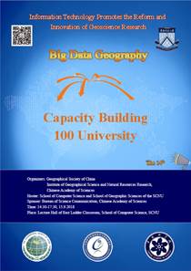
Figure 1 The poster of the14th Seminar of Communications of Big Geographic Data in 100 Universities
|
On September 15, 2018, the 14th Seminar on Communications of Big Geographic Data in 100 Universities was held at the School of Computer Science of South China Normal University (SCNU; Shipai Campus, Guangzhou, China). The goal of this seminar is to implement a national strategy for the promotion of big data in order to integrate and encourage innovations in geography research, teaching, and application. The seminar was jointly organized by the Geographical Society of China (GSC) and the Institute of Geographic Sciences and Natural Resources Research, Chinese Academy of Sciences (IGSNRR/CAS), hosted by the School of Computer Science and School of Geographic Sciences at SCNU and supported by the Bureau of Science Communication, Chinese Academy of Sciences. The event was co-hosted by the Guangdong Domestic Satellite Industry Technology Innovation Alliance.
The seminar was focused on Information Technology Promotes Reform and Innovation of Geoscience Research (Figure 1). By integrating geographic big data, shared publishing, data sources, and application analyses, the event delivered the messages and discussed challenges and solutions of big data driven research and education in geography. More than 100 participants from the School of Computer Science and the School of Geographic Science at SCNU, Guangzhou Geographical Research Institute, South China Agricultural University, and Guangzhou University attended the seminar.
The seminar was co-moderated by Dr. Zhang, J. Q., Associate Prof. of the School of Computer Science, Prof. Zhao, Y. L., Associate Dean of the School of Geographic Science and Vice President of GSC and Prof. Xue, D. S., Dean of the School of Geographic Sciences and Planning of Sun Yat-sen University.
|
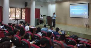
Figure 2 A speech was delivered by Prof. Zhao, Y. L., Associate Dean of the School of Geographic Science, SCNU
|
Prof. Zhao, Y. L. started the seminar by extending a warm welcome to all participants (Figure 2). He delivered the message about the School of Geographical Science at SCNU. It was preceded by the School of Natural History and Geography at Soeng Ken University, which was founded in 1933 and then became the School of History and Geography at Guangdong Art and Science College in 1941. The School of Geography at Guangdong Art and Science College was founded in 1947. The School of Geography at SCNU was created in 1951, and the School of Geographic Science was established in December 2004.
|
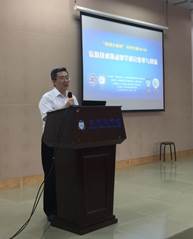
Figure 3 Prof. Xue, D. S., Vice President of the GSC
|
Over the past few decades, the older generation of geographers at SCNU have made significant accomplishments, such as studies in Danxia landforms; Taiwan geography; Pearl River Delta development; South China coast sandstorm landforms; coral reef landforms; comprehensive physical geography; Naming of Nanhai Islands; Guangdong agricultural regionalization; plant geography; and China regional geography. In recent years, researchers have studied a myriad of topics, including the environment and its evolution, global changes and regional responses, the development and management of coastal landforms, regional economies and urban-rural planning, vegetation ecology, cultural geography, remote sensing, and geographic information technology. These scholars have been rewarded with prizes in National Natural Science, National Scientific and Technological Progress, and National Philosophy and Social Science. Researchers in geographic science have also received numerous awards, including the National Excellent Teacher award, National Geographic Information Science and Technology Progress Award; and the South Guangdong Excellent Teacher Award.
On behalf of the GSC, Vice President Xue, D. S. expressed his support and gratitude to SCNU for hosting the Seminar (Figure 3). He stated that the GSC has carried out the Communications of Big Geographic Data in 100 Universities since June 2017. To date, a total of 13 seminars have been successively held by a group of experts from GSC.
The presentations focused on scientific communication activities related to the latest achievements and developments in cutting-edge fields such as the publishing and sharing of global change scientific research data, technical standards, data product cases and data applications, and computing environments. The report session employed interactive discussion to enhance the dissemination effect, and the enterprise was involved in this session, developing a new outreach strategy to expand the applications of big data in geography.
This seminar was consisted of four presentations: Geographical Solutions in the Big Data Era (by Prof. Liu, C., Figure 4), Global Change Science Research Data Publishing (by Prof. Zhu, Y. Q., Figure 5), Zhuhai No. 1 as a Small Satellite with a Big Act (by Tan, J. H., Figure 6), and Geographical Spatiotemporal Big Data in Urban Studies (by Xing, H. F., Figure 7).
|
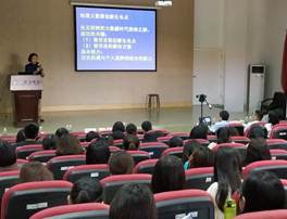
Figure 4 Prof. Liu, C. speaks on big data in geography
|
Prof. Liu, C., leader of the Communications Programme of Big Geographic Data in 100 Universities program, emphasized the importance of geographical big data for innovation and development of geography disciplines and the sustainable development of society. She pointed out that since the data intensive research and the big data development more recently, more than 80% of the research data obtained through observations, experiments, calculations, analyses, and simulations has been directly or indirectly related to geography. Descriptions of geographical phenomena along with the discovery of geographical laws are closely related to geographical data. Big data brings new opportunities to rejuvenate old disciplines in geography and develop new disciplines in the broad field of geography. Geographical big data has promoted trans-disciplinary studies. As geographical big data is incorporated into the traditional field of geography, we geographers should ask ourselves: What are the new scientific challenges? What are the common solutions? Where are the innovative growth points? Can we make practical cases to demonstrate all of these? The answer is positive. She took the Global Change Research Data Publishing & Repository (GCdataPR) as an example to explain the opportunities and solutions for meeting the big data challenges.
Prof. Zhu, Y. Q., Vice Chair of Big Data Working Committee of Geographical Society of China, presented the new mechanism of data publishing and sharing of China. He pointed out that most data obtained by scientists effectively remain dormant. However, almost every scientific project and research activity requires the data of others. Meanwhile, each research group produced their own data. Only when scientific data are circulated and shared can the benefits of the data be fully realized. The success of scientific article publication indicates that data publishing could also become a valuable way to maintain data integrity, prevent scientific fraud, reduce duplication of efforts, promote data sharing, increase the influence of data publishers and organizations in scientific research, reduce barriers to interdisciplinary research endeavors, and improve cooperation in scientific research. Prof. Zhu, Y. Q. further discussed challenges related to the publication of scientific data and suggested the establishment of an evaluation index for scientific data to encourage scientists to contribute to data sharing and publishing. Using GCdataPR as a case study, Prof. Zhu, Y. Q. elaborated on the technical process of publishing scientific data along with the achievements and effects of implementing data publishing in global change science. Through international organizational reviews and metadata interoperability, the
|
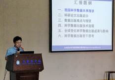
Figure 5 Prof. Zhu, Y. Q.’s presentation on scientific data publishing and sharing
|
|
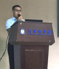
Figure 6 Tan, J. H. delivered message on Zhuhai No. 1 satellite constellation
|
GCdataPR has been integrated into Developing Countries’ Data Publishing and Sharing Infrastructure (CODATA), the World Data System (WDS), and other international systems. Therefore, all teachers and
students are encouraged to actively participate in data publishing to both promote the practice of voluntary data publishing and encourage standardized data citations and data performance assessments.
In the presentation on Zhuhai No. 1 as a Small
Satellite with a Big Act, Tan, J. H. introduced the Zhuhai No. 1 micro-nano satellite constellation system, which was based on dozens of video, hyperspectral, radar, and infrared satellites and was committed to developing a “satellite space information platform” with high spatiotemporal resolution.
This satellite constellation system is facilitated by the Guangdong Domestic Satellite Industry Technology
|
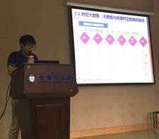
Figure 7 Prof. Xing, H. F. reports on geographical spatiotemporal big data
|
Innovation Alliance, which promotes the development and applications of domestic commercial satellites. The alliance is committed to building satellite-based big data platforms to enhance innovation, break through key technology bottlenecks preventing industrial development, and enhance industrial competitiveness. The Zhuhai No. 1 constellation system currently includes seven orbiting satellites that have the ability to cover the entire world once every five days, revisit certain targets or areas no less than four times a day, and receive 3,000 TB of satellite data from the Earth’s surface each year. Tan, J. H. further introduced the satellite constellation service system and construction practices, including the satellite’s delivery service big data platform, big data trading platform (Guiyang Big Data Exchange), big data application service platform, and the All Clear Waters and Green Mountains in One Map service platform. The application of artificial intelligence to the processing of satellite big data was then discussed. Finally, a large number of test cases were introduced to demonstrate the applications of the Zhuhai No. 1 satellite constellation system in natural resources management, water and environmental monitoring, and other fields. The teachers and students were encouraged to consider including the Zhuhai No. 1 system in their research.
Focused on the Geographical Spatiotemporal Big Data in Urban Studies, Prof. Xing, H. F. presented the research and applications of big geographical spatiotemporal data for urban and smart city studies. First, the research framework of urban spatiotemporal big data and the new urban research paradigm in the era of big data were introduced from the perspectives of city perceptions and data capture. The storage and management of urban spatial data, high-performance calculations and analysis of urban spatial data, urban big data mining, and potential data applications were discussed. Then, a large number of examples were used to introduce the research and applications of geographic spatiotemporal big data in cities, including spatiotemporal information systems of residential unit prices, real estate applications based on spatiotemporal big data, hot-spot analyses of land with permission, and Baidu LBS population migration research. The following application examples of spatiotemporal big data in geography were introduced: visualization of social media data with location information, intelligent monitoring of urban population flow, spatiotemporal behavior analyses of urban residents based on taxi GPS data, urban function analysis from the perspective of street, and urban land use dynamic identification and analysis based on data of subway tickets. A large number of studies have been published in these areas. Since traditional GIS cannot meet the needs of spatiotemporal big data, new technology is needed to handle big data, and the application of big data in geography requires high-quality interdisciplinary studies.
|
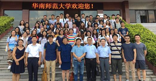
Figure 9 Group photo of the 14th Seminar on Communications of Big Geographic Data in 100 Universities on September 15, 2018 in South China Normal University, Guangzhou, China
|
|
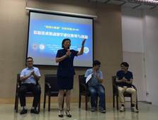
Figure 8 Question and answer session
|
The final portion of the seminar was a question and answer session (Figure 8). The attendees showed a keen interest in the scientific data publishing and sharing. It goes without saying that the seminar is very helpful for both research and education in South China Normal University in big data strategy options, capacity building and applications in practices, especially for the young generation (Figure 9).