Global Change Data Encyclopedia
Qinghai Lake
Gou, Z. J.1 Liu, F. G.1* Liu, C.2 Chen, L. J.3 Chen W. B4. Chen Z. X.5
1. Department of Geographic Sciences, Qinghai Normal University, Xining 810008, China;
2. Institute of Geographic Sciences and Natural Resources Research, Chinese Academy of Sciences, Beijing
100101, China;
3. National Geomatics Center of China??Beijing 100830??China;
4. Keio Research Institute at Shonan Fujisawa Campus (SFC), Keio University, Fujisawa, 2520882, Japan;
5. The Institute of Agricultural Resources and Regional Planning, Chinese Academy of Agricultural Sciences,
Beijing 100081, China
|
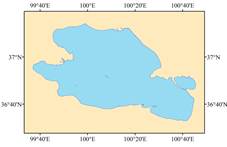
Figure 1 Dataset map of Qinghai Lake
|
Qinghai Lake is known as “Kunuoer” and “Cuowenbu” in the Mongolian and Tibetan languages, which all mean “blue sea”. Qinghai Lake is located in the northeastern of the Qinghai-Tibet Plateau, and is the largest inland saltwater lake on the plateau. Its geo-location is between 36°32′ 56″N and 37°14′5″N, 99°36′58″E and 100°45′32 ″E
(Figure 1), the area of Qinghai Lake is 4,304.79 km² and the shoreline is 501.04 km long (2015) [1]. It is surrounded by Datong Mountain, Riyue Mountain and the South Mountain of Qinghai. There are five islands in the Qinghai Lake: Haixinshan, Sankuaishi, Bird Island, Haixishan and Sand Island, in which the biggest one is 1.17 km² and the least one is 4,666 km²[1]. The Lake is in the continental climate on the plateau, with cold and dry. The annual precipitation is about 370 mm, and the annual evaporation is about 1,500 mm[2]. There are several small rivers around the Lake, they are Buha River, Wuha Shaliu River, Haligen River, Ganzi River, Daotang River and Heima River. Among which, the Buha River has the largest surface runoff in the lake area[3–4]. The surrounding region of Qinghai Lake is attracted spot for tourism (Figure 2-6). It was honored as the National 5A Level Scenic Spot in 2011, and listed as the National Geological Park in 2012.
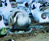
The Bird Island (Figure 3 and Figure 7-11) of Qinghai Lake is located in the northwest corner of the lake. Here flat and surrounded by water on three sides. It is an ideal place of birds’ natural habitat. At the end of spring and the beginning of summer, Tens of thousands of birds have gathered here, and the 4 species of birds, such as the goose, the fish gull, the brown head gull and the cormorant, are the perpetual habitat birds of the bird island. Yearly during the spawning season, the eggs are all over the island, also known as “Egg Island” (Figure 9).
|
|
|
|
|
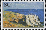
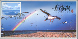
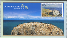
Figure 2 China Post issued Qinghai Lake stamps (3-1) in 2002, the hard copy was donated to Lin Chao Geomuseum by Hu, Q. H.
|
Figure 3 China Post issued Qinghai Lake stamps (3-1) in 2002, the hard copy was donated to Lin Chao Geomuseum by Hu, Q. H.
|
Figure 4 China Post issued Qinghai Lake stamps (3-1) in 2002, the hard copy was donated to Lin Chao Geomuseum by Hu, Q. H.
|
|
|
|
|
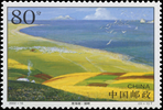
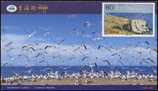
Figure 5 Qinghai Lake on postcards issued by Qinghai Post in 2012, the hard copy was donated to Lin Chao Geomuseum by Liu, C.
|
Figure 6 Qinghai Lake on postcards issued by Qinghai Post in 2012, the hard copy was donated to Lin Chao Geomuseum by Liu, C.
|
| |
|
|
|
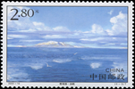
As the only species of Alpine water fish, Huang Fish (Figure 12) is the core species of Qinghai Lake bird symbiosis and aquatic ecosystem, and the high protected animal in the country. In order to adapt to the climatic conditions of the high and cold climate of the Qinghai-Tibet Plateau, the harsh natural environment and the geological movement, the Qinghai Lake turned into a closed lake. Its scales were gradually degraded, and the sparse special scales were retained only on the sides of the anal fin, the sides of the hip fin and the shoulder zone, so called “the naked carp of Qinghai Lake”. The high salinity and high alkaline environment in Qinghai Lake will inhibit the gonadal development and maturation of the Huang Fish. Therefore, the Huang Fish hereditary has the habit of anadromous migration and spawning. Every year, the spring and summer are aggregating against the flow and looking for the suitable spawning place, the farthest traceable flow 180 km, and the most recently also above the 30 km. The growth of the Huang Fish is very slow, average, only 5g a year growing in his lifetime. It has been included in the list of key aquatic wildlife in Qinghai province and adopted a number of measures to seal the lake.
|
|
|
|
|
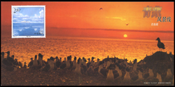
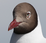
Figure 7 Brown headed gulls on bird island of Qinghai Lake (photo made and donated to Lin Chao Geomuseum by Chen, Z. X., May, 2012)
|
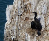
Figure 8 Common cormorants inhabiting bird island in Qinghai Lake (photo made and donated to Lin Chao Geomuseum by Chen, W. B., May, 2012)
|
Figure 9 Qinghai Lake’s National Nature Reserve, egg Island, goose is hatching (photo made and donated to Lin Chao Geomuseum by Chen, W. B., May, 2012)
|
|
|
|
|
Figure 10 Bird Island extreme movie completed on the basis of postcards issued by Qinghai post in 2002, 2002 (the hard copy was donated to Lin Chao Geomuseum by Liu, C.)
|
Figure 11 Qinghai Lake Bird Island extreme movie bird kingdom (the hard copy was donated to Lin Chao Geomuseum by Liu, C.)
|
| |
|
|
|
|

Figure 12 Qinghai Lake was selected as the most beautiful lake in China by China Geographic magazine and Qinghai Post Office issued a postcard to commemorate the Qinghai Lake—Huang Fish in 2005 (the hard copy was donated to Lin Chao Geomuseum by Liu, C.)
|
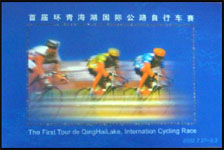
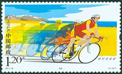
Qinghai Lake surrounding area attracts tourists. In 2005, it was appraised as the most beautiful lake in China by China National Geographic Magazine. In 2011 it was rated as the national 5A tourist attraction. It was listed as the National Geo-park In 2012. At the beginning of 2002, the first international road cycling race of Qinghai Lake was held in Qinghai province (Figure 13-14). After 15 world events, it has been upgraded to the highest international road cycling race in the world and one of the top Asian event.
|
|
|
|
Figure 13 Commemorating sheet (2-1) of the first round of international cycling competition in Qinghai Lake 2002 (the hard copy was donated to Lin Chao Geomuseum by Liu, C.)
|
Figure 14 Bicycle sports commemorative stamps of national postal emission reduction and competitive dual advantage in 2011, Qinghai Lake international road cycling race has promoted the development of bicycle athletic sports (the hard copy was donated to Lin Chao Geomuseum by Liu, C.)
|

References
[1] Gou, Z. J., Liu F. G., Liu, C., et al. Outline of Qinghai Lake [DB/OL].Global Change Research Data Publishing & Repository, 2018. DOI: 10.3974/geodb.2018.02.18.V1.
[2] Sun, Y. L., Li, X. Y., Tang, J., et al. Climate change and hydrological response in the watershed of Qinghai Lake [J]. Resources Science, 2008, 30(3): 354-362.
[3] Feng, Z. K., Li, X. H. Remote sensing monitoring study for water area change and lakeshore evolution of Qinghai Lake in last 20 years [J]. Journal of Paleogeography, 2006, 8(1): 131-141.
[4] Zhang, H. Y., Wu, Y. H., Liu Y. J., et al. Water storage variation of the Qinghai Lake in recent decades based on satellite observation [J]. Progress in Geography, 2018, 37(6): 823-832. DOI: 10.18306/dlkxjz.2018.06.009.